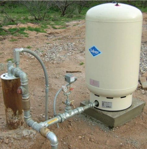
INDIVIDUAL WELLS: The Wells 55 Registry Data Base contains Notices of Intent to Drill, replace, modify, abandon or deepen, registrations, driller reports, completion reports, change of well information, change of ownership, notice of well capping, and abandonment completion reports.
REGISTERED WELLS MONITORED FOR CHANGE IN WATER LEVELS: The Groundwater Site (GWSI) is ADWR’s field-verified data regarding wells and springs collected by personnel from ADWR’s Hydrology Division’s Field Services Section and other co-operating agencies. Use links below to quickly navigate to an interactive map for selected area.
“CLIMAS is a collaboration between the University of Arizona, the Inter Tribal Council of Arizona, and New Mexico State University. The CLIMAS team and partners work to improve the ability of the region’s social and ecological systems to respond and thrive in a variable and changing climate. Climate variability and the long-term warming trend affect social phenomena such as population growth, economic development, and vulnerable populations, as well as natural systems.”
CLIMAS collaborates to help reduce risk and enhance resilience in the face of climate variability and change.
In 2006, a start-up volunteer-reporting system in the Benson Subwatershed transitioned to a larger electronic database at rainlog.org. Information helps scientists track rain variability across the watershed. U of A maps provide specific raingage information. “Rain Mapper” electronically emails participants measurements reported near their neighborhood.
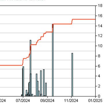
Multiple Year Chart
Climas and SAHRA compile information and make it available to you at this link. On Change Date tab specify Middle and Lower San Pedro view and indicate date range for Map comparison. Click once again on the symbol closest to your residence or area of interest to access data over time. Interested in joining the network? Visit rainlog.org on line.
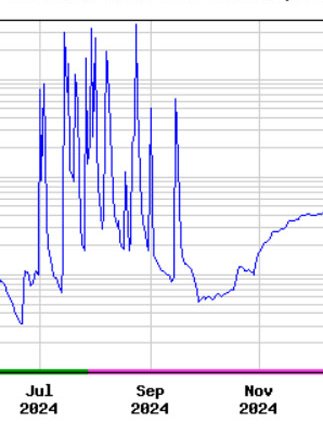
Real-time Stream Flow
CHARLESTON GAGE is operated in cooperation with Cochise County, the Bureau of Land Management, and the Arizona Department of Water Resources. High Data Rate (Site data are transmitted & updated hourly). Parameters measured: water temperature, discharge, sediment.
REDINGTON BRIDGE GAGE is operated through the cooperation of Pinal County and the US Geological Survey. High Rate Data (Site data transmitted & updated hourly). Only parameter available is discharge.